
Río Chico Trail (Ohanes) – PR-A 249
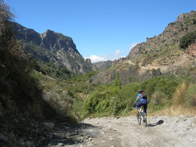
The Río Chico trail (Ohanes) – PR-A 249 is situated in the western part of the province of Almería. It passes through the southern slopes of the Sierra Nevada. It is an area with enormous natural beauty and great contrasts.
Set out from the village of Ohanes in the direction of the sports centre, towards the village bypass; there you can find the information panel for trail PR-A 249.
The start of the trail is a very steep traditional road with slate slabs, surrounded by 'paratos', or cultivated terraces; a few yards from the start on the left is the Cortijo de los Morenos country house. Further on is a large pine wood, with stunning views of the Sierra Nevada National Park and the neighbouring Sierra de Gádor.
After the well-signposted ascent, wind your way down, using the waymarkers as a guide, following the trail as it passes between 'bolina' shrubs, terrace walls and abandoned traditional country houses, 'paratos' or cultivated terraces, threshing floors and ponds, which display the traditional architecture of the Alpujarra mountains. If you follow the waymarkers you will reach the Río Chico river, which you need to cross.
On the other side you will find an information panel about the group of buildings of great ethnographic interest belonging to the Molino de la Herrería windmill; follow the path up a little way to the complex which is on the left.
Continue climbing up until you reach the remains of a traditional country house which is on the left below the path. The trail then continues, now flat and narrow, past a waterfall (originating from the Acequia de Careo irrigation canal). The path carries on and, straight in front, are the remains of another building that forms part of the village's ethnographic and industrial heritage: the electricity plant. You can reach this by following the path, which slopes down slightly, until you reach a crossroads: to the left is the plant, and to the right the trail carries on back to the village of Ohanes.
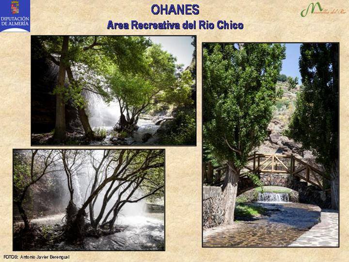
If you turn right, you will go down a very steep cement path, at the end of which you will find a signpost on the right, and the access to a tarmacked lane. This leads directly to the Río Chico recreation area on the left.
The mountain path continues on towards the El Carmen residential area, and on the left is the village's rural complex (botanic garden, hostel and holiday cottages); in front is the village swimming pool. At the end there is another crossroads; to the left is the village bypass, to the right is the road that leads to the nearby village of Beires, and straight on leads directly to the village of Ohanes.
Type of Trail: Circular Trail Status: Approved and Signposted 2004. Total Length: 9.5 km. Sections: 1 Accessibility: It can be done on foot. Download Topographic Guide
Itineraries


Services and infrastructure
Target audiences
Segments
Season
You may be interested


EXPLORE ANDALUSIA
EXPERIENCES


