
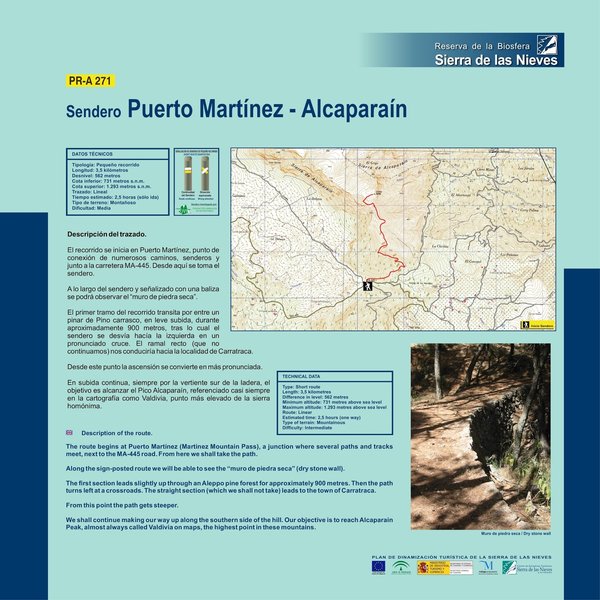
Puerto Martínez – Alcaparaín Trail – PR-A 271

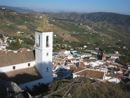
The Puerto Martínez – Alcaparaín Trail – PR-A 271 starts in Puerto Martínez, municipal district of Casarabonela, a place of strategic importance in the past, where the Prieta mountains meet the Alcaparaín mountains and red-billed choughs use the strong wind to surprise us with their acrobatics in full flight. The start of the trail takes us through a pine forest, although we will gradually gain altitude to reach more open areas dominated by scrub. The last section, with sparse vegetation, gives us outstanding views from the triangulation stations of the Valdivia and the Grajo, overlooking the districts of Guadalteba and the Sierra de las Nieves mountains.
We are at an altitude of 740 metres above sea level in an area that is both a defile and a mountain pass, which gives rise to strong air currents. This important strategic location was the reason why the Roman road that started in Malaga on its way to Ronda passed through here and of which there are still some remains. The first section of the route starts at this point, we enter a reforested area where the most important species are the Aleppo pine and the black pine, although mixed in with them you'll find important numbers of trees from the original forest which is being replanted, principally holm oaks and wild olive trees.
After passing through the pine forest we turn off to the left at a pronounced crossroads. If we carried on straight it would take us to the town of Carratraca.
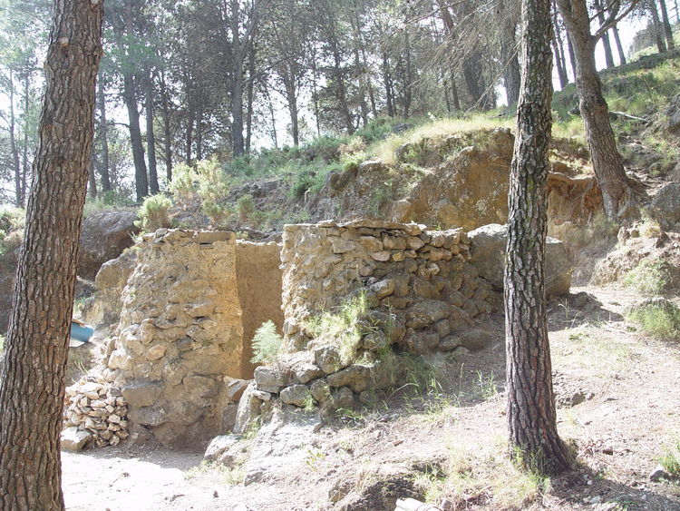
Next to the pathway, on the right hand side, we find a circular pit 2 metres in diameter and between 3 and 4 metres deep, whose lower walls are lined with stones arranged in parallel to the circumference. These are the remains of an old lime kiln, witness to the limestone nature of this land.
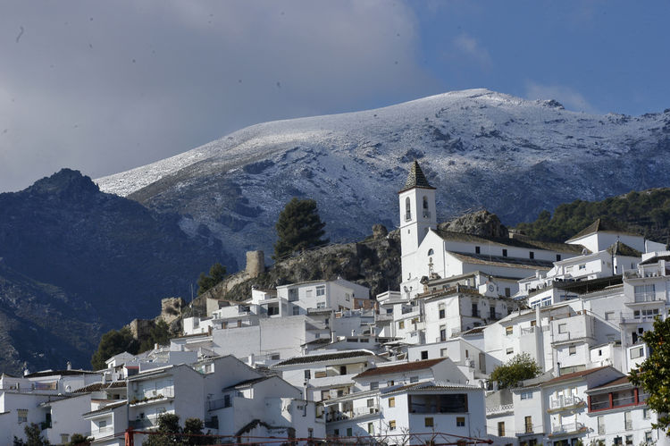
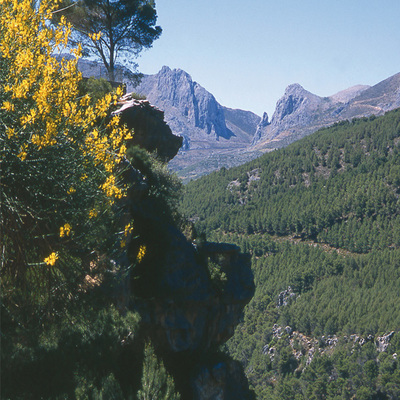
At this point the climb becomes steeper, but we can occasionally stop to enjoy the spectacular views to the south, over the prolific Guadalhorce Valley and the host of villages dotted around this district bordering the Sierra de las Nieves mountains. The most easily visible are Pizarra, Cártama and Alhaurín el Grande, which stretch out towards the lush foothills of the Sierra de Mijas mountains. But the most striking feature of this area is a nearby small reddish mountain range called the Sierra de Robla made up of peridotite which is rich in heavy metals and with an interesting bushy vegetation.
We continue to climb, our aim is to reach the Alcaparaín peak, known as Grajo. This is the easternmost summit in the Sierra de las Nieves Biosphere Reserve and with the considerable altitude of 1,293 m.
Type of Trail: Linear. Trail Status: Approved and Signposted 2005. Total Distance: 3.5 Km. Legs: 1 Accessibility: It can be done on foot. Download Brochure
Itineraries
Services and infrastructure
Target audiences
Segments
Season


EXPLORE ANDALUSIA
EXPERIENCES


